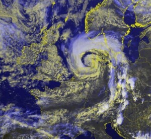
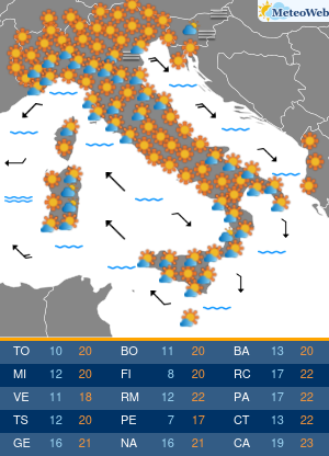
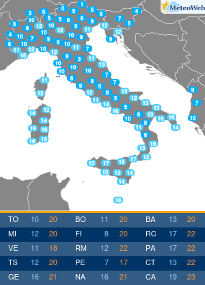
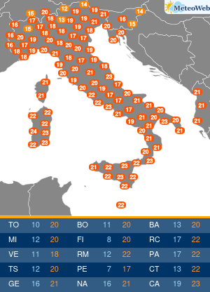
Nuova Allerta Meteo emessa da ESTOFEX (European Storm Forecast Experiment) per il forte maltempo che nelle prossime ore colpirà l’Europa. Il focus è sulla giornata di oggi, mercoledì 5 luglio, con particolare riferimento al pomeriggio-sera quando avremo violenti temporali su gran parte del Continente, da Belgio e Paesi Bassi dove sono attesi violenti tornado, alle zone mediterranee di Spagna, Italia e Balcani.
Nel dettaglio, il bollettino evidenzia il rischio di grandine anche sul Nord Italia, in modo particolare il Nord/Est, anche se i fenomeni più estremi saranno in altri Paesi del Continente.
A level 3 was issued over the NW Netherlands mainly for severe wind gusts and to a lesser extent for tornadoes and heavy rainfall.
A level 2 was issued across the Netherlands and northwest Germany for severe wind gusts, heavy rainfall and to a lesser extent for tornadoes.
A level 2 was issued for parts of Northeast Spain mainly for large hail.
A level 2 was issued across Czechia, East Germany, and Southwest Poland for all hazards.
A level 1 was issued across extreme northern France, Belgium, a large part of North and Central Germany, Poland, Czechia, and Austria for severe wind gusts and across Czechia, eastern Germany and Poland to a lesser extent for tornadoes and large hail.
A level 1 was issued across the southern Alps and north Italy mainly fo large hail and local heavy rainfall.
A level 1 was issued over East Spain mainly for large hail.
A level 1 was issued across the central and eastern Balkan Peninsula mainly for heavy rainfall, and to a lesser extent for large hail.
SYNOPSIS
An intense mid-level vorticity maximum that has transitioned into a closed circulation across the southern North Sea moves to Southwest Sweden. It is associated with a surface low that rapidly develops in the 00 – 12 UTC timeframe producing widespread extreme wind gusts across the level 2 area. A cold front moves quickly eastward across Germany into Poland and southern Sweden. Further south, moderate westerly flow affects the Alpine region and the central Mediterranean, setting the stage for a few more severe hailstorms as CAPE builds diurnally. Across Spain, mid-level flow is markedly stronger, leading to stronger wind shear. Storm coverage is isolated, but may be scattered to widespread in vicinity of the Pyrenees, where a level 2 appears to be warranted. Across the Central and eastern Balkans, flow is much weaker. Abundant humidity and fairly steep lapse rates suggest a risk of local severe weather there.
DISCUSSION
Benelux, Germany, and surrounding regions…
At 22 UTC Wednesday IR/water vapour satellite imagery is consistent with the consensus of the numerical weather prediction models that calculate the rapid development of a small surface cyclone across the southern North Sea ahead of a strong mid/upper-level vorticity maximum. The models suggest that a line of thunderstorms will move north-eastward along a cold front across northern France into the Benelux and Germany prior to the forecast period. Along this front, the strong background wind field and strong low-level shear suggests that sever wind gusts may occur along with a risk of short-lived tornadoes along it. The front should be near a line from Bremen to Frankfurt am Main around 06 UTC.
Further west, across the southern North Sea and the Netherlands a back-bent/instant occlusion will form with associated sting-jet like wind maxima with local wind gust speeds on the order of 30 – 35 m/s, and locally higher. As the cyclone is filled with surface-based and elevated convective elements with isolated lightning, we will consider all wind gusts to be within scope of this ESTOFEX forecast. We estimate the risk of extreme gusts of more than 32 m/s large enough to warrant a level 3 for the region most at risk.Within subsequent ICON-D2 model runs some members show intense, rotating, convective cells embedded within the developing back-bent occlusion over the Netherlands during the 4 UTC – 10 UTC time frame, that could create localized very severe wind swaths with gusts over 40 m/s, this scenario not being supported by other convection-allowing models. A risk of such extreme gusts and tornadoes cannot be ruled out though. As the cyclone matures, the severe westerly winds on the southern flank will translate north-eastward across northwestern Germany.
Central and eastern parts of Germany, Czechia, W Poland…
Along or just ahead of the eastward-moving cold front, new storms are expected to develop during the afternoon. They do so in an environment with adequate CAPE and approximately 20 m/s of deep-layer shear, suggesting that some may become supercells with a risk of large hail and severe wind gusts. Locally, in particular over Czechia, heavy rainfall is an additional notable hazard. Storms that manage to form during the morning ahead of the front will do so in an environment that exhibits higher low-level helicity. As a result, an isolated tornado cannot be ruled out. NWP models suggest that such conditions are most likely near the Polish/Czech border and far northwest Poland.
Southern Czechia, Austria…
Wind shear is lower here than further north, so that less storm organization is expected. Nevertheless, heavy rainfall and possibly some local marginally large hail are possible.
Southern Alps…
Although deep-layer wind shear is relatively modest, 15 m/s may be adequate for some multi- and supercells that, courtesy of the 1000-2000 J/kg of MLCAPE will bear a risk mostly of large hail, and to a lesser extent of heavy rainfall and local severe winds.
Eastern Spain…
Isolated storms are expected to develop once again across the mountain ranges of eastern Spain. Some light forcing for upward motion is expected to increase storm coverage across far northeastern Spain. Since CAPE should be adequate with about 1000 J/kg MLCAPE and deep-layer shear is strong with 25-30 m/s winds, some of them will be able to produce large, and possibly very large (5 cm or more) hail. In addition, a more limited risk of very heavy rainfall will exist.
Balkans…
Across the indicated areas of the Balkans, the flow is weak but moisture abundant, which in combination with fair lapse rates should yield widespread 1500-2500 J/kg CAPE. Storms are expected to form in response to solar heating, and should in spite of the weak wind shear be able to produce heavy rainfall, and locally large hail. Given strong low-level buoyancy an isolated spin-up tornado cannot be ruled out.
Di seguito forniamo i link per l’accesso diretto alle pagine con le previsioni meteo, particolarmente accurate nei dettagli, per le aree geografiche d’Italia (link sempre raggiungibili anche dal Menù in alto in tutte le pagine del sito):
Le previsioni Meteo Regione per Regione:
- Meteo Lombardia
- Meteo Lazio
- Meteo Campania
- Meteo Veneto
- Meteo Sicilia
- Meteo Emilia Romagna
- Meteo Piemonte
- Meteo Puglia
- Meteo Toscana
- Meteo Calabria
- Meteo Sardegna
- Meteo Liguria
- Meteo Marche
- Meteo Abruzzo
- Meteo Friuli Venezia Giulia
- Meteo Trentino Alto Adige
- Meteo Umbria
- Meteo Basilicata
- Meteo Molise
- Meteo Valle d’Aosta
Per monitorare nel modo migliore possibile la situazione meteo in tempo reale, di seguito forniamo un elenco delle pagine con tutte le informazioni utili per seguire il nowcasting meteorologico minuto per minuto:


